 Enesgy
Geospatial World Weekly —
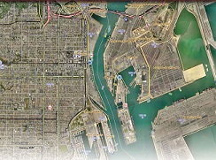 Due to the sheer volume of inventory that ships can carry, ports have larger and more complicated infrastructure than most gateways of commerce. Even the physical structure of ports changes over time, with new docks built and water reclaimed into land on a regular basis. Considering this dynamic environment, officials at the Port of Los Angeles adopted a complete enterprise GIS implementation at the harbour. In 2009, the Port hired GIS consultant NorthSouth GIS and Esri…